Latitude: 50.8732 / 50°52'23"N
Longitude: -2.7258 / 2°43'32"W
OS Eastings: 349025
OS Northings: 108441
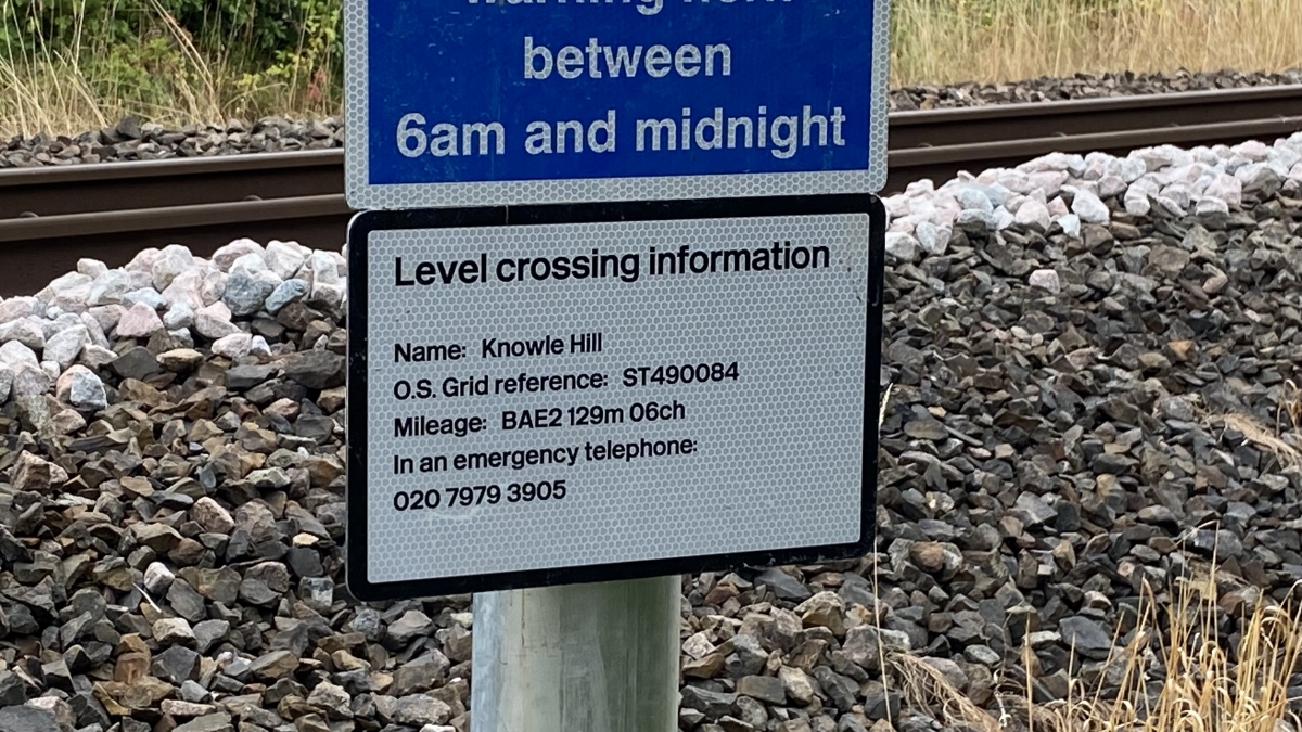
OS Grid: ST490084
Mapcode National: GBR MK.T775
Mapcode Global: FRA 565S.PVQ
Pluscode: 9C2VV7FF+7M
What3Words: monks.photocopy.soccer
Is the location marker in the wrong place? You can help fix that!